Skills Ontario 2026: Students map outbreaks in healthcare institutions
Professionals from different sectors across Canada use geographic information systems (GIS) to understand and make informed decisions about complex issues in our world from gun violence to healthcare to housing shortages. In Education, every Spring, high school students in Ontario get the chance to tackle a real-world issue and test their geospatial analysis skills using professional GIS tools at the Skills Ontario GIS competition. Let’s find out what the challenge and outcome was at the 2026 event.
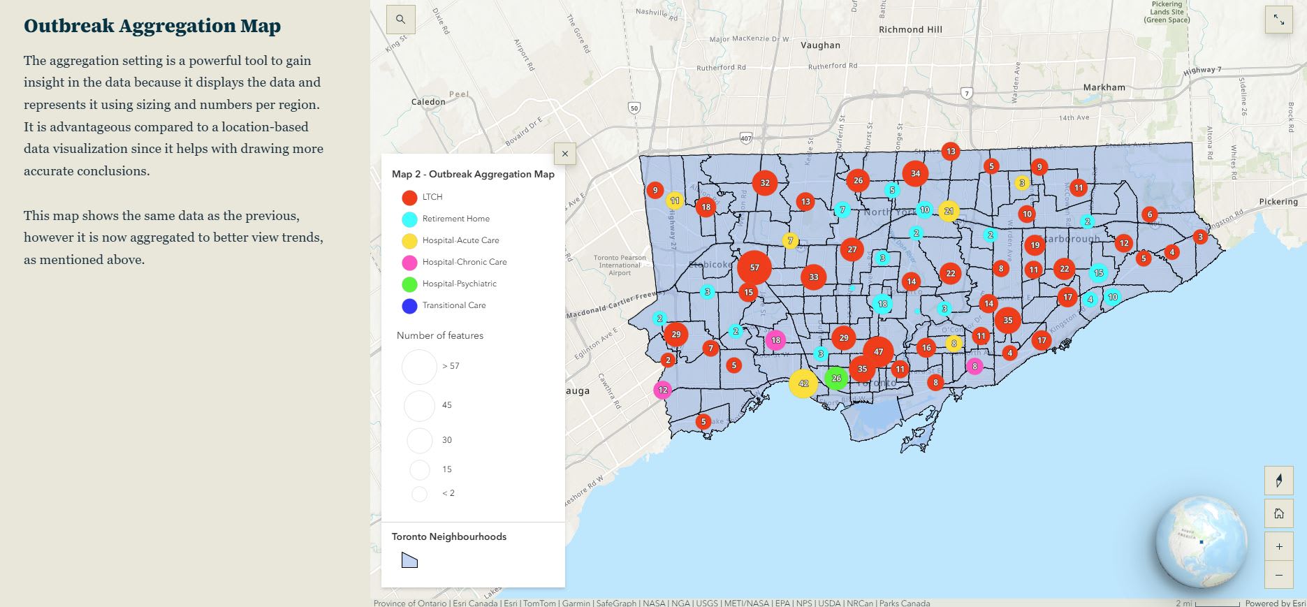
This year, the students used ArcGIS Online, ArcGIS StoryMaps and ArcGIS Instant Apps to complete a question on “Mapping Outbreaks in Healthcare Institutions in Toronto.” Students worked in teams of two to create a series of maps on outbreaks in healthcare institutions that occurred in 2025 and looked for trends in outbreaks across Toronto and considered how they correlate to demographic factors.
In a matter of six hours, teams from the Toronto District School Board, York Catholic District School Board, Bluewater District School Board and Dufferin Peel Catholic School Board completed the tasks required, highlighted their findings in a storymap and presented to the judges.
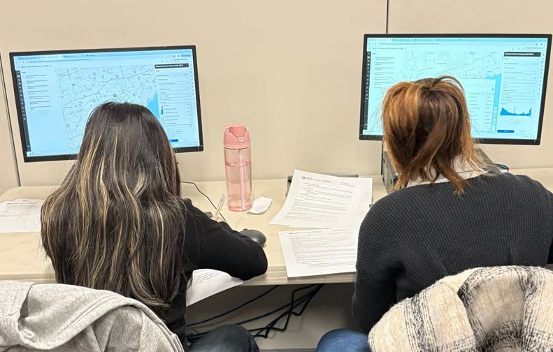 Each year students are given a practical challenge that is tied to issues that are happening in communities in Ontario. Students use ArcGIS to gain insight from the data provided and make decisions throughout the day as a team.
2026 Results
Let’s give a standing ovation to all the participants! Congrats to the York Catholic DSB team for placing first in this year’s competition. The judges were impressed by the clarity of their maps and their presentation skills. A fine job was done by the second and third place teams - Toronto DSB and Bluewater DSB. We hope some of the participants will return next year.
Every year, the students’ work surprises the judges as they are doing real GIS in high school. Many GIS professionals didn’t learn about GIS until they were in university or college.
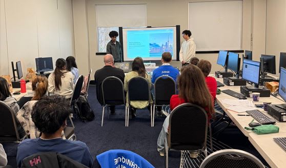 Presentations are an opportunity for the students to highlight the work they have done. It is also a time for judges to ask questions to gain more insight into the teams’ understanding of the topic explored in the competition and to give feedback to the students.
Developing future GIS professionals
By giving students an opportunity to try out their GIS skills and explore a real problem, this annual competition helps to develop future GIS professionals and encourages students to move onto higher education programs in GIS.
Aidan Hawkins is an example of this. From grade nine geography to applied geomatics, discover how GIS expanded the world for Aidan and guided him toward a career built on spatial analysis and mapping. He was also a three-time winner at the Skills Ontario GIS competition.
The Skills Ontario GIS competition also allows students to interact with the judges that are GIS professionals by asking questions and learning from them during the event.
Judges, Thank you!
Every year we rely on the support of our volunteer judges/GIS Ambassadors to help the competition run smoothly. These GIS professionals were from the City of Brampton, Infrastructure Ontario and the City of Hamilton. Thank you, judges, for the support in promoting GIS use in K-12 education!
- Caroline Tiegs, Mapping Specialist, Infrastructure Ontario
- Adam Munro, GIS Analyst, City of Hamilton
- Conrad Petrilla, Analyst, City of Brampton
- Melissa Allin, GIS Specialist, City of Brampton
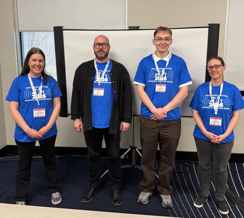 Judges are a very important part of the GIS competition as they show the students the GIS career paths that are possible. Thank you to Caroline, Adam, Conrad and Melissa for your time in supporting this event. From left to right are the 2026 judges: Caroline Tiegs, Adam Munro, Conrad Petrilla and Melissa Allin.
Are you a teacher who wants their students involved in next year’s competition?
Explore past GIS competition questions
To prepare your students for the 2027 competition, go through this year’s question and past years. It’s never too early to start.
Discover GIS Careers
Career Path Series
By exploring this collection of lessons, students will learn not only about GIS itself but also about the myriad of career opportunities it opens up, inspiring the next generation of data analysts, decision-makers and industry innovators.
GeoMinds
Discover how GIS is a pivotal skill set in the digital age that supports decision-making across various industries, including environmental science, urban planning, public health, and beyond. Chart a course to the future, where GIS knowledge is not just an asset but a gateway to innovation and career excellence.
Looking for support in 2027
Are you a GIS Ambassador who wants to support next year’s competition? This could include question ideas and development (January-April) or judging the day of the competition (first Tuesday in May). Reach out and let us know you want to help at k12@esri.ca.
Happy Mapping!