Esri Canada achieves rare ISO 31700-1 Privacy by Design certification
ISO 31700-1 Privacy by Design certification reinforces Esri Canada’s commitment to proactive privacy protection and trusted cloud services.
View
ISO 31700-1 Privacy by Design certification reinforces Esri Canada’s commitment to proactive privacy protection and trusted cloud services.
View
Geographic information system (GIS) provider recognized for helping Canadian municipalities become smarter using location intelligence.
View
Dana McKee spotlights the City of St. Albert, Alberta, emphasizing its contributions to the Community Map of Canada, showcasing how the city uses trusted data and mapping tools to benefit residents.
Watch Video
Get familiar with ArcGIS Workflow Manager by exploring the Work, Manage, and Design tabs and learn how they support your end-to-end GIS workflows.
Watch Video
Watch Video
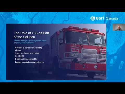
Uncover insights about government operations with the integrating power of GIS.
Find out moreWhat does "smart" truly look like in public works operations for mid-sized Canadian municipalities? How to deliver big, on medium-sized budgets.
View
Hillary Elliott spotlights the City of Medicine Hat’s ongoing contributions to the Community Map of Canada program, emphasizing their provision of diverse and up-to-date mapping data and imagery.
Watch Video
Learn how ArcGIS Business Analyst helps you use location intelligence for smarter business decisions and market analysis.
View
Geospatial technology with artificial intelligence delivers smart mapping and enhanced analytics and decision-making capabilities at speed and scale
View
Stay ahead of the forecast with the Weather Engine app, created by Huntsville and Lake of Bays using the Community Map of Canada for real-time local weather conditions. Weather Engine
Watch Video
Stay ahead of the forecast with the Weather Engine app, created by Huntsville and Lake of Bays using the Community Map of Canada for real-time local weather conditions. Margaret Stead
Watch Video
Learn how local governments in Canada are using GIS.
View MoreManage public feedback using the Manager Instant App. Provide an easy to use solution for your data reviewer to engage with.
View
Explore Halifax Regional Municipality’s award-winning approach to applying geographic information system (GIS) technology—from traditional mapping services to outcome-driven solutions.
Watch Video
City of Steinbach’s geographic information system (GIS) developer honoured for contributions to the geospatial profession
View
Quickly gather and manage public feedback using Instant Apps. Boost engagement and streamline your data collection process.
View
Strategic use of location intelligence enables better services throughout Atlantic Canada’s largest municipality
View
Discover how Overture Maps is transforming open map data through global collaboration, standardization, and quality validation to support GIS and transportation innovation.
Watch Video
Unlock the power of open data licensing! On this episode of the Geographical Thinking podcast, Paul Heersink shares how clear terms drive better maps and smarter data use in GIS.
Watch Video
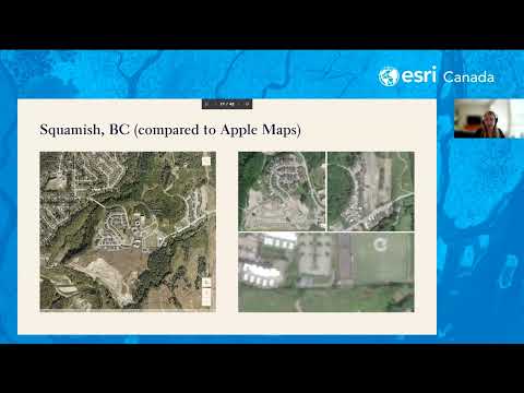
Watch the webinar recording where we explore the Community Map of Canada – the definitive basemap built by Canadians for Canadians.
Watch Video
Join us for an engaging discussion as we explore the Community Map of Canada – the definitive basemap built by Canadians for Canadians. Attendees will see how easy it is to access the basemap, work wi
Watch Video
Loading More...