The new workspace: How COVID-19 is shaping return-to-work plans
This blog post discusses how companies and organizations across various industries are planning for their teams’ safe return-to-work. Esri’s Workspace app and ArcGIS Indoors can help shape plans and re-establish business operations.
After months of living under COVID-19 restrictions, we’re beginning to see initiatives for economic recovery across Canada. In Toronto, Mayor John Tory recently announced plans to reinstate outdoor patio dining at certain eateries across the city. Through the CafeTO initiative some restaurants and bars will offer full-service dining outdoors by expanding their patios onto public property, making the additional space needed to operate while adhering to social distancing rules. Although emergency orders in Ontario are still in place and indoor dine-in service continues to be prohibited, this announcement is a positive sign toward businesses reopening and people soon returning to work. As restaurants and businesses across all industries makes preparations to reopen, safety for their staff and patrons will be paramount.
Safety over efficiency
In the past, businesses have made it a priority to find operating efficiencies to save both time and money. Understandably, this objective has taken a back seat to safety in the COVID-19 world. Restaurants will need to consider how to achieve less crowded dining rooms, safe queueing processes and expanded space for curbside pickup; all of which will require more company resources to accomplish. In office-based workspaces, managers will need to demonstrate and communicate safety measures for employees, in addition to implementing organizational changes. New strategies will emerge to ensure distancing rules are met and contact is minimized.
But what if we can strike a balance between safety and efficiency?
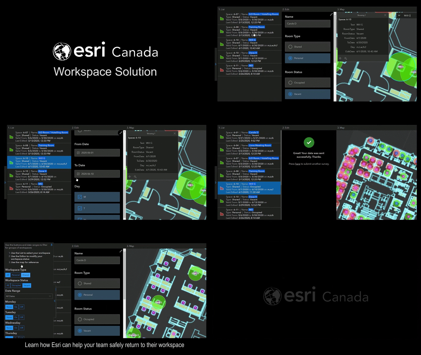
As businesses plan for and adapt to new protocols, technology will be at the center of operational changes that provide both safety and efficiency. In a recent discussion with MarketWatch, Esri’s Brian Cross says, “Companies need to show employees through their floor plans that their offices are safe”. With technology like Esri Canada’s Workspace app, organizations can map and analyze existing floor plans and traffic flows to determine how space should be redesigned. When used together with Esri’s Business Continuity Solution, businesses gain a greater understanding of the health of their staff, facilities, and their operations through maps and dashboards, and effectively communicate through an organizational hub.
What might a workspace solution look like in a restaurant setting? Imagine having an interactive map of the dining area where management can view floorplans and configure seating arrangements according to government imposed guidelines. They can also monitor facility use patterns such as heavily travelled areas and plan maintenance and cleaning schedules accordingly. These examples highlight ways in which spatial technology can help businesses implement new measures that deliver both safety and operational efficiency.

Certainly, workplaces across all industries will look to implement safety controls before welcoming employees back on-site. This requirement may pose immediate challenges for management from restructuring seating arrangements, to managing floor density and foot traffic patterns, to monitoring facility sanitizing practices. Managers can address these challenges and more with the workspace management and indoor mapping solutions.
ArcGIS Indoors is an indoor mapping and GIS solution that can be used in a variety of indoor mapping scenarios, including the tracking of people’s movements. The ArcGIS Indoors capabilities can play a key role in any organization’s COVID-19 recovery and return to the workplace activities by providing a foundation for:
Space Management: Plan and assign the work location that conforms to distancing guidelines.
Proximity Analysis & Tracing: Perform a spatial analysis to define work locations or redesign floor layouts that meets guidelines.
Operations & Maintenance: Plan, manage, and communicate information such as facility layout changes, sanitization projects and restricted or off-limits areas.
Density Management: ArcGIS Indoors supports density management with tools such as tracking and geofencing
Situational Awareness: Dashboard to summarize facility related data such as staff on premises, incidents, assets, and equipment—all in the crucial context of location.
Regardless of the industry, businesses have proven they can adapt quickly to the conditions imposed by the pandemic. The next step is to optimize with technology to ensure a safe workplace for when employees return to the workplace and operations restart.
To learn more about Esri's Workspace app and Business Continuity Solution, watch this webinar: Optimize your safe return-to-office, and see how location intelligence can inform your back-to-work plans.