5 ways to start a new school year with maps, apps, data, and inquiry
The beginning of a new school year is a great time to try something new! ArcGIS provides engaging resources that help students investigate questions, analyze data, and learn new skills. Here are five ways to kick off the school year with maps, apps, data, and inquiry.
1. Map it in Minutes
Students can get started with ArcGIS Online mapping and explore some cool apps in the Map it in Minutes tutorial. Each of the six activities takes approximately six minutes to complete.
Whether you're a newbie or looking for a refresher, this resource provides a great entry point into ArcGIS Online.
2. Data Exploration
ArcGIS Online is a place for discovery. Whether you are looking for data, maps or apps in the Data Exploration tutorial, you will learn how to find trusted content in ArcGIS Online to begin your classroom inquiry and to create your first map.
Learn how to:
- Search for authoritative data and content
- Find ArcGIS Living Atlas content
- Access live feed data and much more!
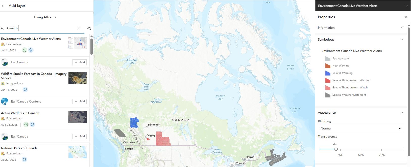
Search and discover “Canada” Living Atlas content that you can use in your inquiry.
With this resource, you and your students will build confidence in finding, evaluating, and using authoritative content while developing valuable data literacy and critical-thinking skills.
3. Try an Activity or Lesson
Activities
Activities allow students to interact with a map or app that has already been created, where they will explore focused questions connected to the curriculum.
Food Security
In this activity, students will explore maps and consider the following: How could climate change affect global food security, and what strategies can ensure a sustainable food supply for future generations?
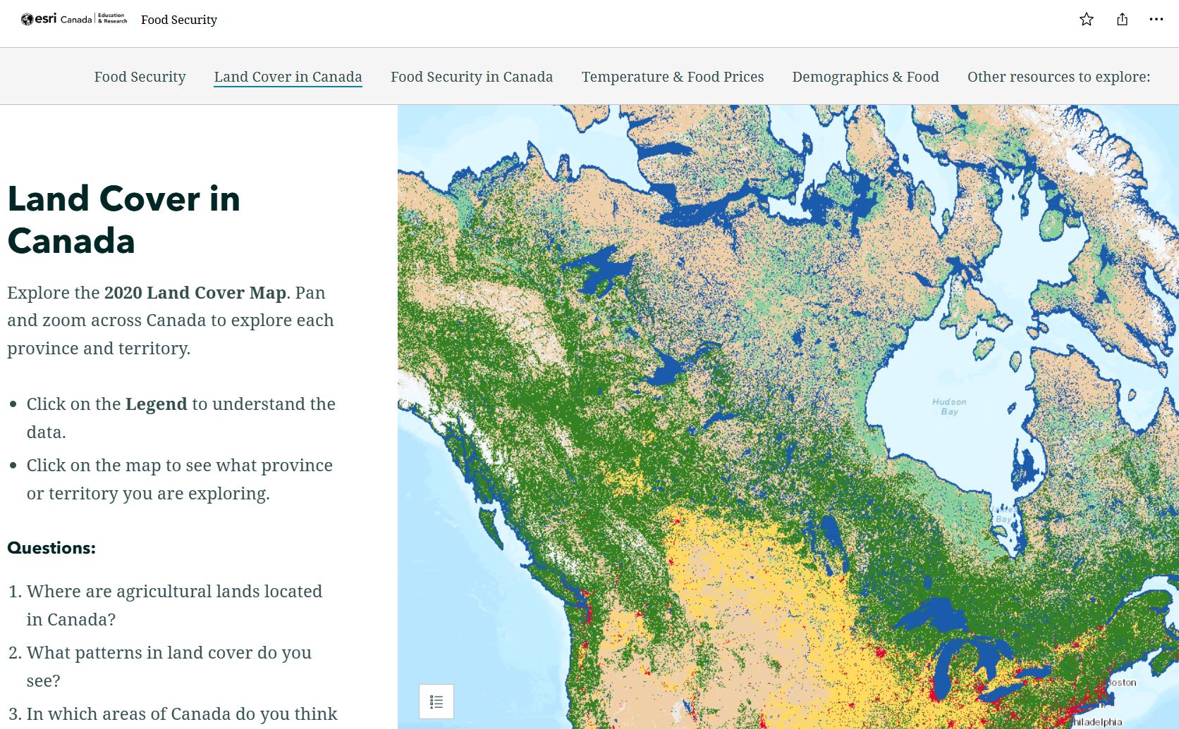
Explore a Land Cover map in this activity and answer questions to gain a deeper understanding of food security in Canada.
Quick Data, Cool Map
In this activity, students will learn how to access recent earthquake data from USGS to create a quick map in the ArcGIS Online Map Viewer. You will use GeoJSON data to make your map.
Lessons
Lessons get students using ArcGIS Online to create maps and analyze data to understand a topic, make a decision, or solve a problem.
Heat and Cool Islands
In this lesson, students will explore and identify the elements of urban areas which can affect the temperature and create heat island and cool island effects. This lesson is also available in French.
Remembering the Battle of Vimy Ridge
In this lesson, students are historians who will use ArcGIS Online to explore an important event in history through a spatial lens. They will explore the movements of the Canadian troops during the Battle of Vimy Ridge (April 9-12, 1917), analyse and mark the location of significant features in the battle, and examine the crucial role geography played in this historic conflict.
Explore more activities and lessons from our Resource Finder.
4. Introduction to GIS Certification
K-12 students can get certified in GIS and learn the importance of maps and data in understanding our world. This certification is also for the SHSM Environment GIS elective.
The certification helps students:
- Develop technical and analytical skills in mapping
- Build confidence using GIS tools
- Gain insight into how GIS is used in different industries
- Demonstrate their knowledge in a storymap
5. Integrate ArcGIS apps into your teaching and learning
ArcGIS apps extend the capabilities of mapping and spatial exploration. Tell your story in an ArcGIS StoryMap, create a field study using ArcGIS Survey123 and highlight the data findings in an ArcGIS Dashboard.
Discover StoryMaps
ArcGIS StoryMaps lets students create engaging digital stories that combine maps, images, videos, and text. Whether documenting a field study, exploring local history, or sharing research findings, StoryMaps helps students communicate their learning through interactive, location-based storytelling. Learn how to create your first StoryMap.
Read about how educators in Canada are using StoryMaps in teaching and learning.
Bringing History to Life: How StoryMaps Help Students Connect with WWI
In this blog post, discover how Bluewater District School Board educators Jennifer Morris and Hillary Weppler use ArcGIS StoryMaps to help grade 10 history students connect with WWI history, their families and their region of Grey County in meaningful ways.
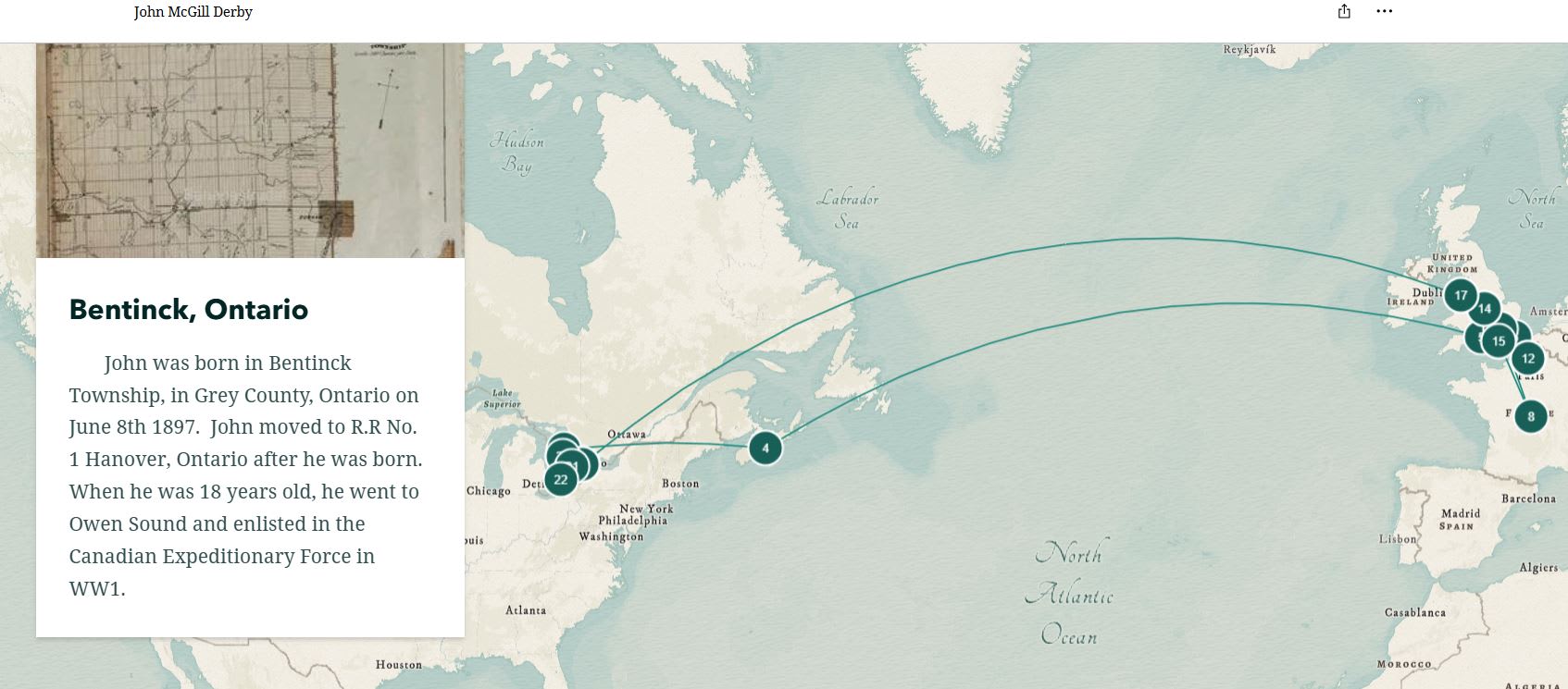 This storymap follows a soldier from Grey County, Ontario in WWI.
On the Map with Sarah Gallah
In this blog post, learn about Sarah Gallah, a high school educator with a passion for bringing geography and science to life using ArcGIS StoryMaps.
Fieldwork Learning Path
Learn how you can create your own fieldwork project using ArcGIS tools like ArcGIS Survey123, ArcGIS Dashboards and ArcGIS StoryMaps. This will allow your students to collect data, analyze results, visualize findings, and communicate their conclusions.
Project ideas include:
- Cross-curricular citizen science project
- Schoolyard biodiversity survey
- Tree inventory
- Community sustainability survey
- Active transportation study
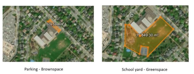 Measurements in ArcGIS Online made in the Citizen Science – Walk through of ArcGIS with Chris Cocek.
When students engage in real-world fieldwork, they become active participants, problem-solvers, and contributors to their communities.
No matter where you are on your GIS journey, these resources offer accessible ways to use ArcGIS with your students.
Looking for more resources?
The Esri Canada K-12 Resource Finder includes tutorials, activities, lessons and course collections.