Choosing the right Instant Apps template for your project
Not sure which Instant Apps template to choose? This guide groups templates by user goals and provides real-world examples to help you select the right app template for your project.
One of the biggest strengths of ArcGIS Instant Apps is the wide range of templates available, which helps organizations quickly share maps and data without needing any coding. Whether you are creating a public information portal or an operational editing app, you will often find more than one template that can achieve what you need.
With so many options available, selecting a template can sometimes feel overwhelming. It's common to start by browsing templates and comparing features, but a more effective approach is to start with a different question:
What do I want my audience to accomplish?
Rather than organizing templates alphabetically, this article groups them according to common user goals. By focusing on required workflows instead of template names, you can quickly narrow your options and choose an app that delivers the right experience for your audience.
Start with the user's goal
Most Instant Apps projects can be grouped into one of six common objectives:
Explore: Users want to interact with a map and discover information.
Find: Users need to locate something nearby or determine which area they belong to.
Compare: Users need to evaluate differences across locations, datasets or time periods.
View: Users want to explore photos, imagery or guided map presentations.
Edit: Users need to collect information, update records or manage operational workflows.
Showcase: Users need access to multiple maps, apps and related resources.
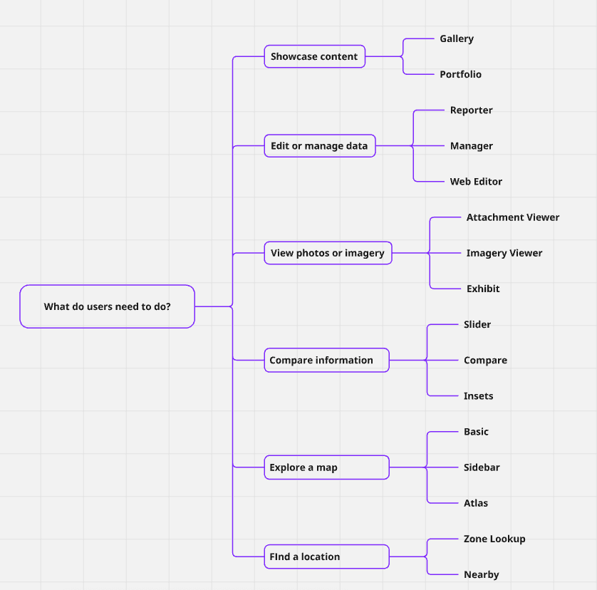
Goal-based Instant Apps template selection guide.
Explore maps
If your primary objective is helping users explore and interact with data, several templates are designed specifically for map-centric experiences.
Basic: The Basic template provides a streamlined map viewer with essential navigation tools and optional functionality such as time-based visualization and layer comparison. It is ideal for simple embedded maps and lightweight public information applications.
Sidebar: The Sidebar template is one of the most versatile templates available. It combines a map-centric layout with a dedicated side panel that can display legends, feature details and other supporting information. It's a good choice when users need both the map and supporting information visible at the same time.
Atlas: The Atlas template is designed for exploration. With tools like layer management, measurement, sketching and adding layers, it works well when users need to actively investigate map content rather than simply view it.
Interactive Legend: The Interactive Legend template turns the legend into a filtering tool. Users can click categories directly in the legend to focus on specific features, making it ideal for thematic maps with many classes or categories.
Chart Viewer: The Chart Viewer template places maps and charts side by side, allowing users to explore spatial patterns and statistics together. It's a strong choice when charts are a central part of the story, not just a supplement to the map.
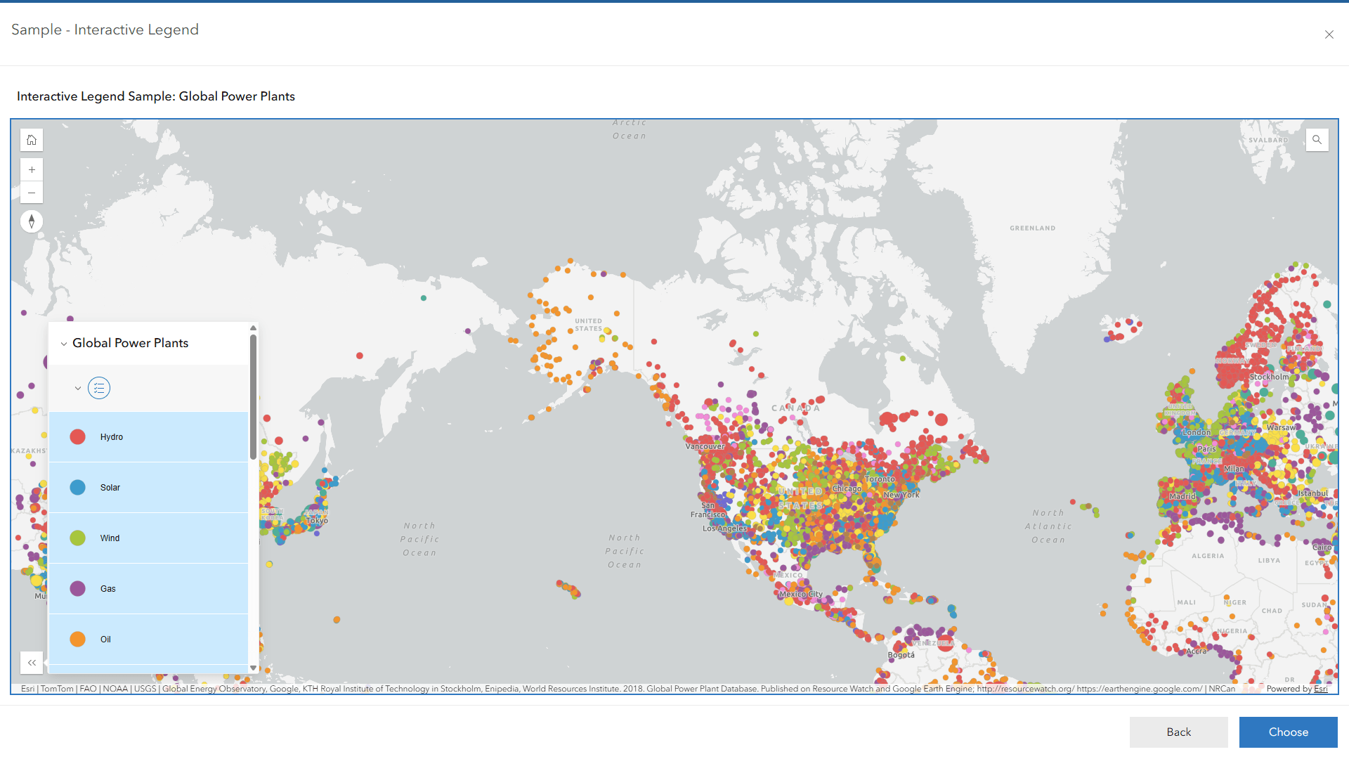 Interactive Legend template.
Find locations and areas
Many GIS applications intended for the public are designed to help users find a location or determine which area they belong to. Whether someone is searching for the nearest library, identifying a school catchment or finding the district associated with an address, these applications are built around location-based questions. Several Instant Apps templates focus specifically on these workflows.
Nearby: The Nearby template helps users discover points of interest around a selected address or location. Results are organized by proximity, making it ideal for applications where users want to find the nearest facility or service and get directions to it.
Typical examples include:
-
Schools
-
Libraries
-
Parks
Zone Lookup: The Zone Lookup template helps users determine which district, boundary or service area is associated with a specific address or location. Instead of showing what is nearby, it answers questions such as "Which school catchment am I in?" or "Which electoral district serves this address?"
Common use cases include:
-
School catchment lookup
-
Electoral districts
-
Utility service areas
Public Notification: The Public Notification template helps users create lists of features based on a location, a drawn area or a search buffer. Selected records can then be exported to CSV or PDF, making it ideal for workflows that require identifying and sharing a group of affected properties or addresses.
Common use cases include:
- Identifying properties affected by a proposed development
- Creating address lists for road closure notifications
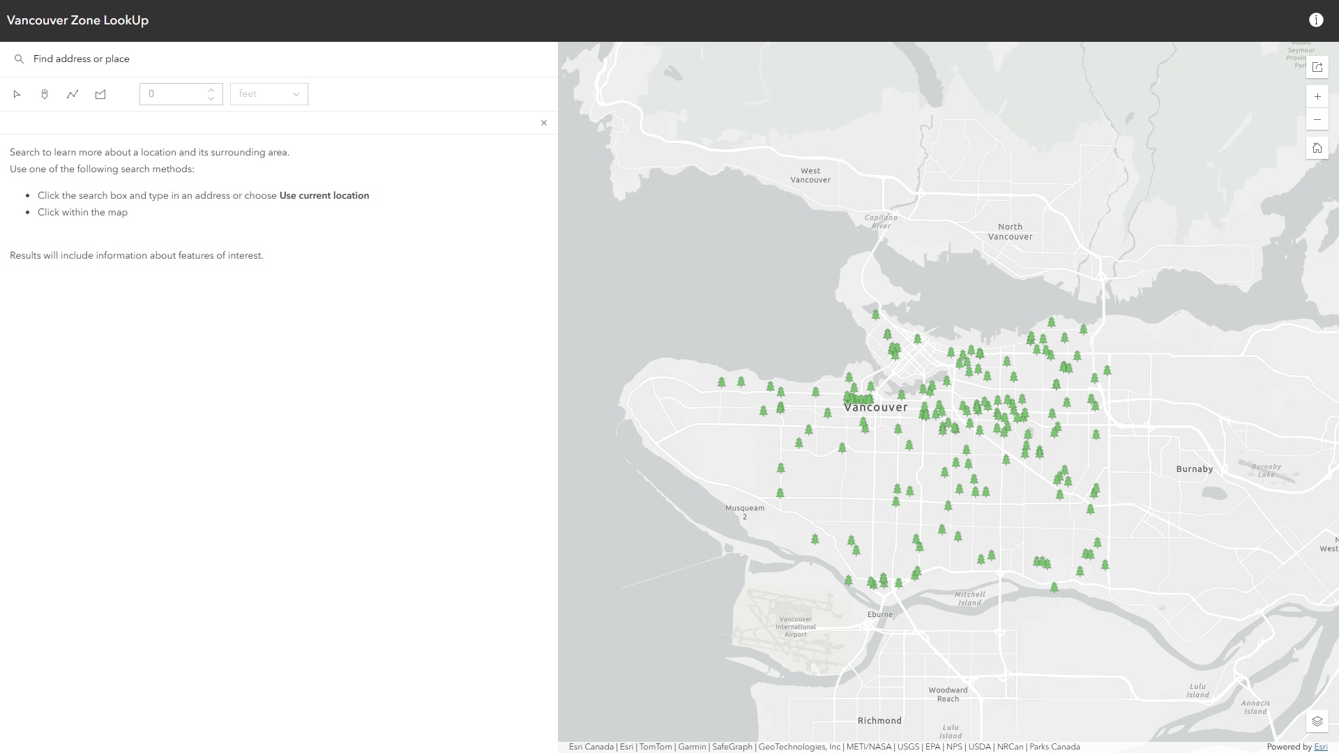 An app built using the Zone Lookup template.
Compare Information
Comparison is one of the most effective ways to communicate change. Whether the goal is to compare imagery, visualize historical trends or evaluate alternative scenarios, several templates are designed around side-by-side analysis.
Compare: The Compare template places maps side by side, allowing users to compare different datasets, scenarios or map layers for the same location. It is a strong choice when users need to compare two maps and quickly identify spatial differences, whether across time periods, datasets or planning scenarios.
Slider: The Slider template focuses on change over time or across a sequence of values. Users can move a slider or play an animation to see how a dataset evolves, making it ideal for historical trends, forecasts and time-enabled data.
Insets: The Insets template brings multiple geographic locations into a single view. Rather than comparing different datasets or time periods, it helps users compare places that are geographically separated without having to pan or switch between maps.
Potential applications include:
- Historical imagery comparison
- Population change visualization
- Climate analysis
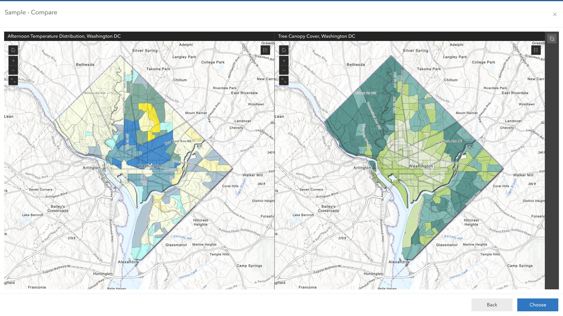 An app built using the Compare template.
View Photos, Media and Imagery
Some projects rely less on attributes and more on visual information. Instant Apps includes several templates designed to help users explore datasets enriched with photos, videos, imagery and other media.
Attachment Viewer: The Attachment Viewer template is designed for datasets with photos, videos, PDFs and other file attachments. It allows users to browse features and their associated media side by side, making the attachments the primary focus of the experience.
Common examples include:
-
Asset inspections
-
Field surveys
-
Infrastructure inventories
Imagery Viewer: The Imagery Viewer template is built specifically for imagery layers and raster data. It includes tools that help users examine imagery and related metadata, making it a better choice for image analysis than a general purpose map viewer.
Exhibit: The Exhibit template presents maps through a sequence of slides, guiding users through locations, themes or key findings one step at a time. It is ideal when the goal is to tell a story with a map rather than letting users freely explore it.
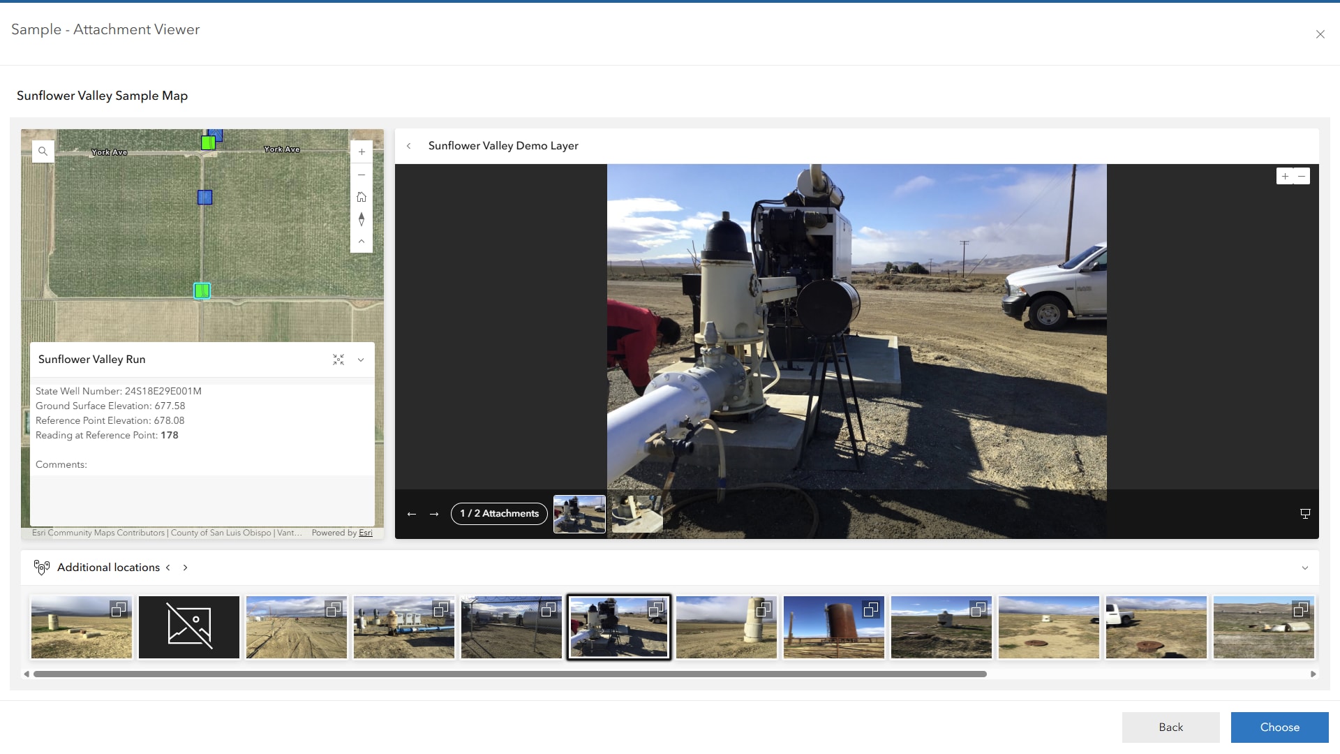 An app built using the Attachment Viewer template.
Edit and Manage Data
While Instant Apps are often associated with sharing information, several templates also support data collection and editing workflows.
Reporter: The Reporter template allows users to submit issues, observations or feedback directly through a map. It is designed for data collection workflows where members of the public or field staff need to report new information.
Common examples include:
-
Graffiti reporting
-
Trail maintenance requests
-
Infrastructure issues
Manager: The Manager template is designed for reviewing and managing records that already exist. Its combination of map and table views makes it ideal for searching, filtering, updating and tracking large numbers of features.
Web Editor: The Web Editor template provides a full-featured editing experience for GIS data. In addition to updating attributes, users can create, modify and delete features directly on the map using dedicated editing tools.
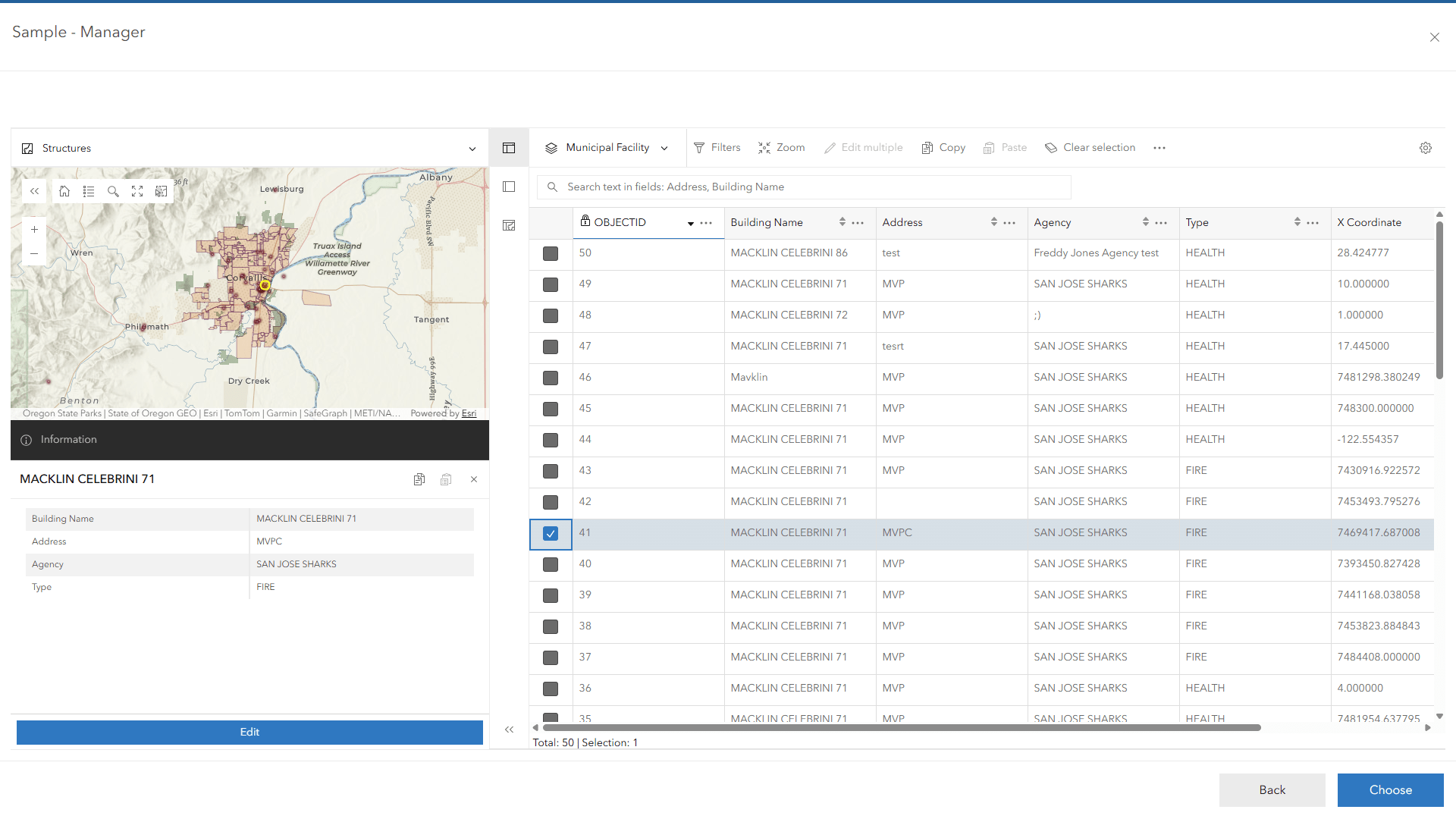 An app built using the Manager template.
Showcase collections of content
Sometimes a single map is not enough. Organizations frequently need to organize and present multiple resources related to a topic or initiative.
Gallery: The Gallery template is designed for browsing and discovering content. It displays items from an ArcGIS group and includes filtering, searching and sorting tools, making it a good choice when users need to find specific maps, apps or other resources from a larger collection.
Common examples include:
-
Open data collections
-
Project libraries
-
Organization content galleries
Portfolio: The Portfolio template is designed to bring multiple resources together in a single app. It allows users to browse maps, apps, PDFs, images and webpages from one interface, making it a good choice for projects that need to present content from several sources.
Common examples include:
- Project websites
- Community information portal
- Initiative showcase pages
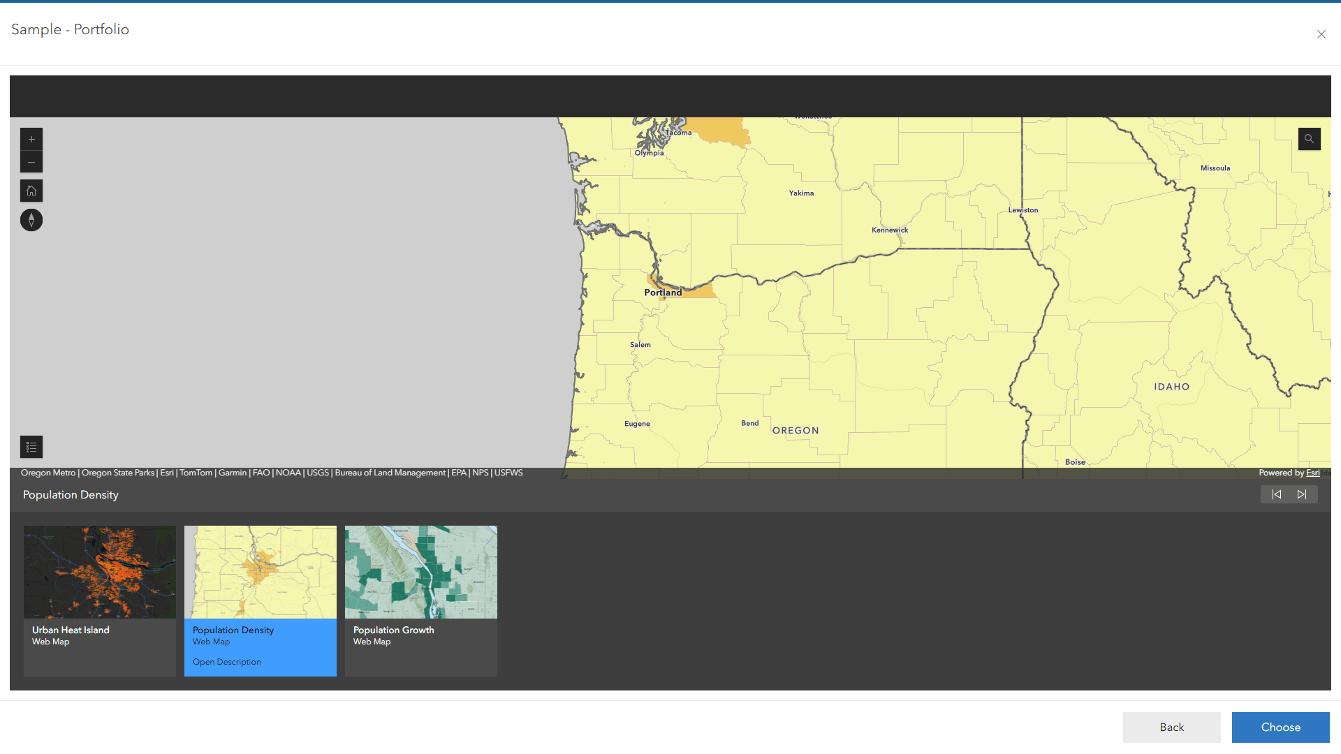 An app built using the Portfolio template.
Other specialized templates worth exploring
Several templates address more specialized workflows and may be the perfect fit for specific projects. These include:
-
3D Viewer – Designed for viewing and exploring 3D scenes, making it a good choice for projects that focus on buildings, infrastructure or terrain.
-
Observer – Similar to 3D Viewer but adds dynamic statistics that update as users move around the scene, helping users understand what they are currently viewing.
-
Countdown – Displays features in a ranked list based on a selected attribute, making it ideal for highlighting top, bottom or highest-value locations.
-
Streamflow Viewer – Designed specifically for streamflow forecast data, combining maps, charts and time controls to visualize changing conditions over time.
-
Data Explorer (Beta) – Allows users to explore map data by asking questions in natural language instead of using traditional filters and analysis tools.
While these templates may not be as widely used as Sidebar, Nearby or Compare, they are worth exploring when your project has a specialized workflow that aligns with their strengths.
Conclusion
Choosing an Instant Apps template starts with understanding what your audience needs to accomplish. In many cases, the fastest path to the right template is to identify the primary task users need to complete and work backward from there.
If users need to explore data, start with Sidebar, Atlas or Basic. If they need to find locations, consider Nearby or Zone Lookup. If comparison is the goal, Compare and Slider may provide the best experience. For media-rich content, Attachment Viewer and Exhibit are strong candidates, while operational workflows are well supported through Reporter, Manager and Web Editor.
By focusing on user goals rather than template names, you can narrow the available options, simplify the selection process, and deliver a more effective experience for your audience.